Geolocate

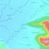
Balbadri topographic map

Click on the map to display elevation.

About this map

Name: Balbadri topographic map, elevation, terrain.

Location: Balbadri, Mandro, Sahibganj, Jharkhand, India (25.23716 87.47907 25.25002 87.49446)

Average elevation: 81 m

Minimum elevation: 33 m

Maximum elevation: 224 m

Other topographic maps

Click on a map to view its topography, its elevation and its terrain.

Teliagarhi

India > Jharkhand > Mandro

Average elevation: 68 m

Khairbani Ithari

India > Jharkhand > Mandro > Jirlikarharia

Average elevation: 90 m

Gear up for your next adventure:

⛺Bushcraft Tarp - Versatile emergency shelter or gear protection
🔥Emergency Fire Starter - Reliable ignition source for all weather conditions
🔋Lithium AA Batteries - Long-lasting power that performs in extreme cold
🧥Insulated Jacket - Keep warm in cold outdoor conditions
🥾Lightweight Hiking Shoes - Comfortable shoes for day hikes

As an Amazon Associate, this site earns from qualifying purchases at no extra cost to you.