Geolocate

Gumpang topographic map

Click on the map to display elevation.

About this map
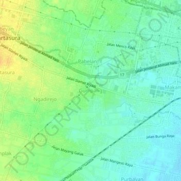
Name: Gumpang topographic map, elevation, terrain.

Location: Gumpang, Sukoharjo, Central Java, 57162, Indonesia (-7.58375 110.73916 -7.54375 110.77916)

Average elevation: 113 m

Minimum elevation: 102 m

Maximum elevation: 129 m

Other topographic maps

Click on a map to view its topography, its elevation and its terrain.

Lapangan Makamhaji

Indonesia > Central Java > Sukoharjo > Gentan > Kuyudan

Average elevation: 104 m

Tangkisan

Indonesia > Central Java > Sukoharjo

Average elevation: 98 m

Gear up for your next adventure:

🔦UV Flashlight - Detect minerals or specific insects in the dark
🧰Survival Kit - Essential gear for emergencies in the wilderness
🦯Trekking Poles - Reduced impact on joints for steep topographic climbs
🏃Hydration Running Vest - Carry water and maps close to your body for speed
🧭GPS Outdoor Watch - Smart watch for navigation and fitness tracking in nature

As an Amazon Associate, this site earns from qualifying purchases at no extra cost to you.