Geolocate

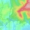
Nidda topographic map

Click on the map to display elevation.

About this map

Name: Nidda topographic map, elevation, terrain.

Location: Nidda, Wetteraukreis, Hesse, 63667, Germany (50.38754 8.97620 50.43091 9.04001)

Average elevation: 180 m

Minimum elevation: 126 m

Maximum elevation: 326 m

Other topographic maps

Click on a map to view its topography, its elevation and its terrain.

Der Haag

Germany > Hesse > Wetteraukreis > Melbach

Average elevation: 155 m

Kreischberg

Germany > Hesse > Wetteraukreis > Büdingen

Average elevation: 213 m

Gear up for your next adventure:

🧰Emergency Multi-Tool - Compact multi-tool for outdoor survival
🍽️Titanium Camping Spork - Ultralight and indestructible eating utensil
🔭Compact Monocular - One-handed bird watching and trail spotting
🧦Hiking Liner Socks - Thin base layer to prevent friction and blisters
🎒Backpack Rain Cover - External shield to keep your entire pack dry

As an Amazon Associate, this site earns from qualifying purchases at no extra cost to you.