Geolocate

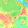
Whatoro topographic map

Click on the map to display elevation.

About this map

Name: Whatoro topographic map, elevation, terrain.

Location: Whatoro, Kaipara District, Northland, New Zealand (-35.69633 173.71073 -35.69623 173.71083)

Average elevation: 522 m

Minimum elevation: 282 m

Maximum elevation: 697 m

Other topographic maps

Click on a map to view its topography, its elevation and its terrain.

Wairoa River

New Zealand > Northland > Kaipara District

Average elevation: 42 m

Lake Kaiiwi

New Zealand > Northland > Kaipara District

Average elevation: 79 m

Lake Rototuna

New Zealand > Northland > Kaipara District

Average elevation: 120 m

Wairoa River

New Zealand > Northland > Kaipara District

Average elevation: 42 m

Gear up for your next adventure:

🧥Insulated Jacket - Keep warm in cold outdoor conditions
🍽️Titanium Camping Spork - Ultralight and indestructible eating utensil
🧦Thermal Socks - Warm socks for winter hiking or camping
🎒Hiking Backpack - Lightweight and ergonomic backpacks for day hikes or multi-day treks
💡Compact LED Flashlight - Powerful and portable flashlight for outdoor use

As an Amazon Associate, this site earns from qualifying purchases at no extra cost to you.