Geolocate

La Haye topographic map

Click on the map to display elevation.

About this map

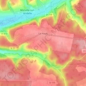
Name: La Haye topographic map, elevation, terrain.

Location: La Haye, Dieppe, Seine-Maritime, Normandy, Metropolitan France, 76780, France (49.45015 1.41078 49.47299 1.47671)

Average elevation: 142 m

Minimum elevation: 64 m

Maximum elevation: 184 m

Other topographic maps

Click on a map to view its topography, its elevation and its terrain.

Rouen

France > Normandy > Seine-Maritime > Rouen

Average elevation: 103 m

Gear up for your next adventure:

🥾Trail Hiking Boots - Supportive boots for rough trails
🧭GPS Handheld Device - Reliable GPS navigation for outdoor adventures
🧢Sun Protection Cap - Breathable cap to protect from sun exposure
🥾Mountain Hiking Shoes - Shoes with superior grip for mountainous terrain
Camping Tent - Weather-resistant tents suitable for 2 to 6 people

As an Amazon Associate, this site earns from qualifying purchases at no extra cost to you.