Geolocate

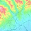
Pinggan River topographic map

Click on the map to display elevation.

About this map

Name: Pinggan River topographic map, elevation, terrain.

Location: Pinggan River, Tungkil, Minglanilla, Cebu, Central Visayas, 6064, Philippines (10.23773 123.80778 10.26190 123.81529)

Average elevation: 16 m

Minimum elevation: 0 m

Maximum elevation: 106 m

Other topographic maps

Click on a map to view its topography, its elevation and its terrain.
Cadulawan

Philippines > Cebu > Minglanilla

Average elevation: 98 m

Guindaruhan

Philippines > Cebu > Minglanilla

Average elevation: 143 m

Tubod

Philippines > Cebu > Minglanilla

Average elevation: 92 m

Gear up for your next adventure:

🧥Softshell Hiking Jacket - The perfect balance of wind protection and breathability
🦌Outdoor Trail Camera - Monitor wildlife activity near your favorite spots
🥾All-Terrain Hiking Boots - Versatile boots for varied hiking conditions
🧳Compression Sacks - Maximize space in your backpack by shrinking gear
🥾Mountain Hiking Shoes - Shoes with superior grip for mountainous terrain

As an Amazon Associate, this site earns from qualifying purchases at no extra cost to you.