Geolocate

Cupiagua topographic map

Click on the map to display elevation.

About this map

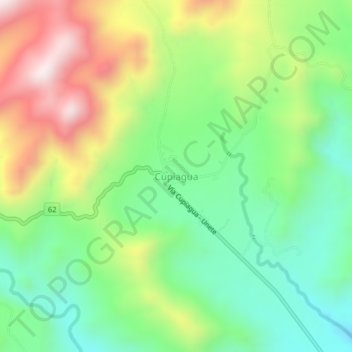
Name: Cupiagua topographic map, elevation, terrain.

Location: Cupiagua, Aguazul, Casanare, RAP Llanos, Colombia (5.21615 -72.66164 5.25615 -72.62164)

Average elevation: 740 m

Minimum elevation: 466 m

Maximum elevation: 1,177 m

Gear up for your next adventure:

🥾Hiking Leggings - Comfortable leggings for outdoor activities
🔭Compact Monocular - One-handed bird watching and trail spotting
🥾Hiking Boots - Sturdy boots providing ankle support and traction on rugged trails
🥾Approach Shoes - Shoes designed for climbing approaches and rugged trails
🥾Waterproof Trail Shoes - Shoes designed to handle wet terrain

As an Amazon Associate, this site earns from qualifying purchases at no extra cost to you.