Geolocate

Georgetown topographic map

Click on the map to display elevation.

About this map

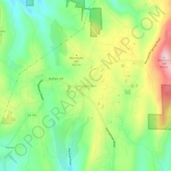
Name: Georgetown topographic map, elevation, terrain.

Location: Georgetown, El Dorado County, California, United States (38.88684 -120.85855 38.92684 -120.81855)

Average elevation: 787 m

Minimum elevation: 659 m

Maximum elevation: 978 m

Other topographic maps

Click on a map to view its topography, its elevation and its terrain.

Gear up for your next adventure:

🔦UV Flashlight - Detect minerals or specific insects in the dark
🥾Approach Shoes - Shoes designed for climbing approaches and rugged trails
🥾Approach Boots - Comfortable boots for hiking and climbing approaches
🎒Backpack Rain Cover - External shield to keep your entire pack dry
Camping Groundsheet - Protect your tent from moisture and dirt

As an Amazon Associate, this site earns from qualifying purchases at no extra cost to you.