Geolocate

Mersey Forest topographic map

Click on the map to display elevation.

About this map

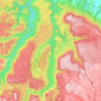
Name: Mersey Forest topographic map, elevation, terrain.

Location: Mersey Forest, Meander Valley, Tasmania, Australia (-41.86567 146.07236 -41.55847 146.32330)

Average elevation: 866 m

Minimum elevation: 221 m

Maximum elevation: 1,482 m

Other topographic maps

Click on a map to view its topography, its elevation and its terrain.

Frog Hill

Australia > Tasmania

Average elevation: 875 m

Mount Kate

Australia > Tasmania

Average elevation: 995 m

Tasman Peninsula

Australia > Tasmania > Tasman > Fortescue

Average elevation: 167 m

Mount Jukes

Australia > Tasmania

Average elevation: 773 m

Ulverstone

Australia > Tasmania > Ulverstone

Average elevation: 37 m

Bullock Hill

Australia > Tasmania > Grove

Average elevation: 147 m

Highland Waters

Australia > Tasmania > London Lakes

Average elevation: 759 m

Stillwater Hill

Australia > Tasmania

Average elevation: 353 m

Legges Tor

Australia > Tasmania

Average elevation: 1,457 m

Rowlands Hill

Australia > Tasmania

Average elevation: 388 m

Recherche Bay

Australia > Tasmania

Average elevation: 10 m

Bastyan Dam

Australia > Tasmania > Tullah

Average elevation: 233 m

Gear up for your next adventure:

🦶Hiking Shoe Insoles - Added support for high arches and long days on feet
🔦LED Flashlight - Powerful and long-lasting flashlight for camping and emergencies
🔥Camping Stove - Portable stoves to cook outdoors with ease
🥾Mountain Trail Shoes - High-traction shoes for mountain trails
🧰Survival Kit - Essential gear for emergencies in the wilderness

As an Amazon Associate, this site earns from qualifying purchases at no extra cost to you.