Geolocate

Tala topographic map

Click on the map to display elevation.

About this map

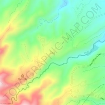
Name: Tala topographic map, elevation, terrain.

Location: Tala, Orani, Bataan, Central Luzon, Philippines (14.73428 120.41010 14.77428 120.45010)

Average elevation: 376 m

Minimum elevation: 189 m

Maximum elevation: 670 m

Gear up for your next adventure:

🥾Waterproof Hiking Boots - Essential footwear for rugged terrain and wet Canadian trails
🧭GPS Tracker - Track your location in remote areas safely
🪜Heavy Duty Carabiners - Multi-use clips for securing gear to your backpack
🛌Down Sleeping Bag - Superior warmth-to-weight ratio for cold nights
🛶Waterproof Dry Bags - Keep electronics and clothes dry during river crossings

As an Amazon Associate, this site earns from qualifying purchases at no extra cost to you.