Geolocate

Marianka topographic map

Click on the map to display elevation.

Marianka

The village lies at an altitude of 220 metres and covers an area of 3.22 km². It has population of 2,272 people.

Wikipedia (CC-BY-SA 3.0)

About this map

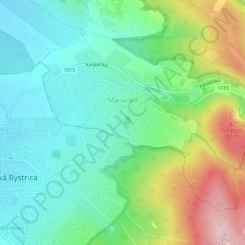
Name: Marianka topographic map, elevation, terrain.

Location: Marianka, District of Malacky, Region of Bratislava, 900 33, Slovakia (48.23562 17.04419 48.25508 17.08256)

Average elevation: 249 m

Minimum elevation: 169 m

Maximum elevation: 425 m

Gear up for your next adventure:

🕶️Polarized Sunglasses - Reduces glare from snow and water at high elevations
🧥Thermal Layer - Insulating layer for cold outdoor conditions
🧣Evaporative Cooling Towel - Beat the heat during intense summer climbs
🎒Fully Waterproof Backpack - Total protection for photography gear and electronics
🔦LED Headlamp - Hands-free lighting for early morning starts or late finishes

As an Amazon Associate, this site earns from qualifying purchases at no extra cost to you.