
Thank you for supporting this site ❤️
Make a donation
Make a donation
Gear up for your next adventure:
As an Amazon Associate, this site earns from qualifying purchases at no extra cost to you.
Black topographic map
Click on the map to display elevation.
Thank you for supporting this site ❤️
Make a donation
Make a donation
Gear up for your next adventure:
As an Amazon Associate, this site earns from qualifying purchases at no extra cost to you.
About this map
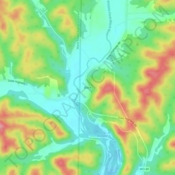
Name: Black topographic map, elevation, terrain.
Location: Black, Reynolds County, Missouri, United States (37.51144 -90.95318 37.55144 -90.91318)
Average elevation: 269 m
Minimum elevation: 222 m
Maximum elevation: 343 m
Thank you for supporting this site ❤️
Make a donation
Make a donation
Gear up for your next adventure:
As an Amazon Associate, this site earns from qualifying purchases at no extra cost to you.
Other topographic maps
Click on a map to view its topography, its elevation and its terrain.
Current River Conservation Area
United States > Missouri > Reynolds County > Ellington
Average elevation: 250 m