Geolocate

Olympic Park topographic map

Click on the map to display elevation.

About this map

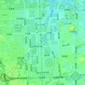
Name: Olympic Park topographic map, elevation, terrain.

Location: Olympic Park, Yayuncun, Chaoyang District, Beijing, China (39.98681 116.38061 40.00871 116.39459)

Average elevation: 47 m

Minimum elevation: 41 m

Maximum elevation: 54 m

Other topographic maps

Click on a map to view its topography, its elevation and its terrain.

Louzizhuang

China > Beijing > Chaoyang District

Average elevation: 38 m

Banbidian

China > Beijing > Chaoyang District

Average elevation: 36 m

Shigezhuang

China > Beijing > Chaoyang District

Average elevation: 33 m

Feijia Cun

China > Beijing > Chaoyang District > Feijia Cun

Average elevation: 38 m

Yayuncun

China > Beijing > Chaoyang District > Yayuncun

Average elevation: 47 m

Gear up for your next adventure:

🧥Ultralight Puffy Jacket - Maximum warmth that packs down to the size of an orange
🛁Quick-Dry Microfiber Towel - Space-saving towel that dries rapidly on the move
🦟Insect Repellent - Keep mosquitoes and black flies away in wooded areas
🧥Fleece Jacket - Warm and lightweight jacket for layering
🩹Compact First Aid Kit - Pre-packed essentials for common trail injuries

As an Amazon Associate, this site earns from qualifying purchases at no extra cost to you.