Geolocate

Zamora topographic map

Click on the map to display elevation.

About this map
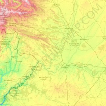
Name: Zamora topographic map, elevation, terrain.

Location: Zamora, Castile and León, Spain (41.11717 -7.03404 42.25418 -5.22887)

Average elevation: 803 m

Minimum elevation: 192 m

Maximum elevation: 2,162 m

Gear up for your next adventure:

🌬️Windproof Camp Stove - Efficient cooking even on exposed mountain peaks
🍽️Titanium Camping Spork - Ultralight and indestructible eating utensil
🥾Hiking Shoes - Durable and comfortable shoes for trail hiking
🔥Camping Stove - Portable stoves to cook outdoors with ease
🛶Canoe Life Vest - Safety vest for water sports

As an Amazon Associate, this site earns from qualifying purchases at no extra cost to you.