Geolocate

Liex topographic map

Click on the map to display elevation.

About this map

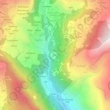
Name: Liex topographic map, elevation, terrain.

Location: Liex, Epaillon, Antey-Saint-André, Aosta Valley, 11020, Italy (45.76982 7.57400 45.80982 7.61400)

Average elevation: 1,327 m

Minimum elevation: 703 m

Maximum elevation: 1,977 m

Gear up for your next adventure:

🧳Compression Sacks - Maximize space in your backpack by shrinking gear
🩹Moleskin Blister Pads - Direct protection for painful foot pressure points
🪜Heavy Duty Carabiners - Multi-use clips for securing gear to your backpack
Camping Coffee Maker - Brew fresh coffee anywhere on the topographic map
🧦Hiking Liner Socks - Thin base layer to prevent friction and blisters

As an Amazon Associate, this site earns from qualifying purchases at no extra cost to you.