
Make a donation
Gear up for your next adventure:
As an Amazon Associate, this site earns from qualifying purchases at no extra cost to you.
Place Raoul de Godewarsvelde topographic map
Click on the map to display elevation.
Make a donation
Gear up for your next adventure:
As an Amazon Associate, this site earns from qualifying purchases at no extra cost to you.
About this map
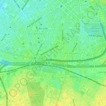
Name: Place Raoul de Godewarsvelde topographic map, elevation, terrain.
Average elevation: 32 m
Minimum elevation: 21 m
Maximum elevation: 43 m
Make a donation
Gear up for your next adventure:
As an Amazon Associate, this site earns from qualifying purchases at no extra cost to you.
Other topographic maps
Click on a map to view its topography, its elevation and its terrain.
Hellemmes
France > Hauts-de-France > Nord > Lille
Administrativement, elle faisait partie de la châtellenie de Lille. L'altitude de la ville varie de 26,50 à 30 mètres.
Average elevation: 33 m
Lille
France > Hauts-de-France > Nord > Lille
La ville de Lille est située à environ 20 mètres d'altitude dans un élargissement de la vallée de la Deûle. À cet endroit, les derniers affleurements crayeux (Sénonien et Turonien) de la région naturelle du Mélantois plongent à l’ouest sous les Weppes, et, au nord, sous le Barœul, deux régions…
Average elevation: 32 m