
崇明区 topographic map
Interactive map
Click on the map to display elevation.
About this map
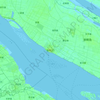
Name: 崇明区 topographic map, elevation, terrain.
Location: 崇明区, 上海市, 202150, 中国 (31.46555 121.23271 31.78555 121.55271)
Average elevation: 2 m
Minimum elevation: -4 m
Maximum elevation: 13 m
崇明位于长江三角洲,地势平坦,海拔一般在3.2~4.2米之间。岛上最高点为人造的金鳌山,高12米。
Other topographic maps
Click on a map to view its topography, its elevation and its terrain.