
Thank you for supporting this site ❤️
Make a donation
Make a donation
Gear up for your next adventure:
As an Amazon Associate, this site earns from qualifying purchases at no extra cost to you.
Namunyaz topographic map
Click on the map to display elevation.
Thank you for supporting this site ❤️
Make a donation
Make a donation
Gear up for your next adventure:
As an Amazon Associate, this site earns from qualifying purchases at no extra cost to you.
About this map
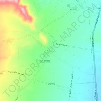
Name: Namunyaz topographic map, elevation, terrain.
Location: Namunyaz, Char Asiab, Kabul Province, Afghanistan (34.33361 69.09824 34.37361 69.13824)
Average elevation: 1,902 m
Minimum elevation: 1,839 m
Maximum elevation: 2,038 m
Thank you for supporting this site ❤️
Make a donation
Make a donation
Gear up for your next adventure:
As an Amazon Associate, this site earns from qualifying purchases at no extra cost to you.