Geolocate

Pishin topographic map

Click on the map to display elevation.

About this map

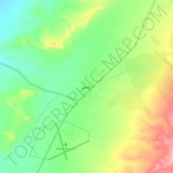
Name: Pishin topographic map, elevation, terrain.

Location: Pishin, Balochistan, 86700, Pakistan (30.54287 66.95664 30.62287 67.03664)

Average elevation: 1,556 m

Minimum elevation: 1,494 m

Maximum elevation: 1,661 m

Gear up for your next adventure:

👟Leg Gaiters - Keep debris, mud, and snow out of your boots
🥾Hiking Shorts - Breathable shorts suitable for summer hikes
🧴First Aid Kit - Essential first aid supplies for outdoor emergencies
Lightweight Camping Tent - Portable shelter optimized for Canadian backcountry camping
🧤Insulated Winter Gloves - Heavy-duty protection for sub-zero Canadian adventures

As an Amazon Associate, this site earns from qualifying purchases at no extra cost to you.