
Squirrel Lake topographic map
Click on the map to display elevation.
About this map
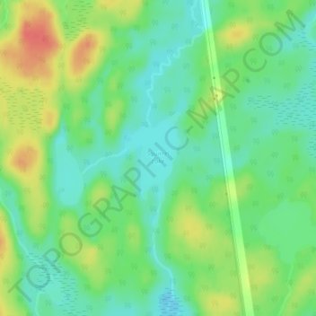
Name: Squirrel Lake topographic map, elevation, terrain.
Average elevation: 360 m
Minimum elevation: 338 m
Maximum elevation: 394 m
Kenora District trails, hiking, mountain biking, running and outdoor activities
Other topographic maps
Click on a map to view its topography, its elevation and its terrain.
Sioux Narrows
Canada > Ontario > Kenora District > Sioux Narrows-Nestor Falls Township
Average elevation: 329 m
Nestor Falls
Canada > Ontario > Kenora District > Sioux Narrows-Nestor Falls Township
Average elevation: 337 m
Berry Lake
Canada > Ontario > Kenora District > Sioux Narrows-Nestor Falls Township
Average elevation: 340 m
Nestor Falls
Canada > Ontario > Kenora District > Sioux Narrows-Nestor Falls Township
Average elevation: 337 m