
Thank you for supporting this site ❤️
Make a donation
Make a donation
Gear up for your next adventure:
As an Amazon Associate, this site earns from qualifying purchases at no extra cost to you.
Rivetta topographic map
Click on the map to display elevation.
Thank you for supporting this site ❤️
Make a donation
Make a donation
Gear up for your next adventure:
As an Amazon Associate, this site earns from qualifying purchases at no extra cost to you.
About this map
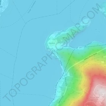
Name: Rivetta topographic map, elevation, terrain.
Location: Rivetta, Dorio, Lecco, Lombardia, 22824, Italia (46.09243 9.29521 46.13243 9.33521)
Average elevation: 319 m
Minimum elevation: 188 m
Maximum elevation: 1,213 m
Thank you for supporting this site ❤️
Make a donation
Make a donation
Gear up for your next adventure:
As an Amazon Associate, this site earns from qualifying purchases at no extra cost to you.