
La Estrella topographic map
Interactive map
Click on the map to display elevation.
About this map
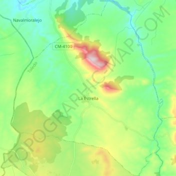
Name: La Estrella topographic map, elevation, terrain.
Location: La Estrella, La Jara, Toledo, Castilla-La Mancha, España (39.64117 -5.15640 39.75144 -5.03269)
Average elevation: 532 m
Minimum elevation: 369 m
Maximum elevation: 914 m