
Thank you for supporting this site ❤️
Make a donation
Make a donation
Gear up for your next adventure:
As an Amazon Associate, this site earns from qualifying purchases at no extra cost to you.
Begonte topographic map
Click on the map to display elevation.
Thank you for supporting this site ❤️
Make a donation
Make a donation
Gear up for your next adventure:
As an Amazon Associate, this site earns from qualifying purchases at no extra cost to you.
About this map
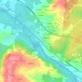
Name: Begonte topographic map, elevation, terrain.
Location: Begonte, Tierra Chá, Lugo, Galicia, 27373, España (43.13015 -7.70516 43.17015 -7.66516)
Average elevation: 429 m
Minimum elevation: 388 m
Maximum elevation: 491 m
Thank you for supporting this site ❤️
Make a donation
Make a donation
Gear up for your next adventure:
As an Amazon Associate, this site earns from qualifying purchases at no extra cost to you.