Geolocate

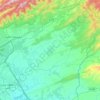
Blue Area topographic map

Click on the map to display elevation.

About this map

Name: Blue Area topographic map, elevation, terrain.

Location: Blue Area, Zone 1, Islamabad Capital Territory, 44010, Pakistan (33.68205 73.03879 33.76205 73.11879)

Average elevation: 621 m

Minimum elevation: 498 m

Maximum elevation: 1,241 m

Other topographic maps

Click on a map to view its topography, its elevation and its terrain.

Simly

Pakistan > Islamabad Capital Territory > Tijal

Average elevation: 745 m

Zone IV

Pakistan > Islamabad Capital Territory

Average elevation: 647 m

I-16

Pakistan > Islamabad Capital Territory

Average elevation: 522 m

Zone IV

Pakistan > Islamabad Capital Territory

Average elevation: 647 m

Zone 2

Pakistan > Islamabad Capital Territory

Average elevation: 558 m

Zone V

Pakistan > Islamabad Capital Territory

Average elevation: 522 m

Zone III

Pakistan > Islamabad Capital Territory

Average elevation: 659 m

Zone 1

Pakistan > Islamabad Capital Territory

Average elevation: 599 m

Gear up for your next adventure:

🧭Orienteering Kit - Tools for map reading and navigation in the wild
🩹Compact First Aid Kit - Pre-packed essentials for common trail injuries
🧥Waterproof Hiking Jacket - Protect yourself from rain and wind while hiking
🪑Insulated Seat Pad - Protect your seat from cold rocks and wet logs
🥾Approach Boots - Comfortable boots for hiking and climbing approaches

As an Amazon Associate, this site earns from qualifying purchases at no extra cost to you.