Geolocate

Sunset topographic map

Click on the map to display elevation.

About this map

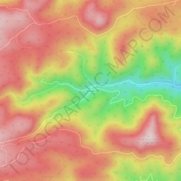
Name: Sunset topographic map, elevation, terrain.

Location: Sunset, Boulder County, Colorado, United States (40.01582 -105.48889 40.05582 -105.44889)

Average elevation: 2,591 m

Minimum elevation: 2,277 m

Maximum elevation: 2,790 m

Gear up for your next adventure:

🧭GPS Tracker - Track your location in remote areas safely
🔭Compact Monocular - One-handed bird watching and trail spotting
🛶Kayak Accessories - Essential gear for safe and fun kayaking adventures
🌬️Windproof Camp Stove - Efficient cooking even on exposed mountain peaks
🧭GPS Outdoor Watch - Smart watch for navigation and fitness tracking in nature

As an Amazon Associate, this site earns from qualifying purchases at no extra cost to you.