Geolocate

Binukawan topographic map

Click on the map to display elevation.

About this map

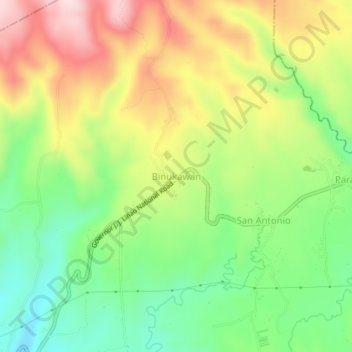
Name: Binukawan topographic map, elevation, terrain.

Location: Binukawan, Bagac, Bataan, Central Luzon, 2107, Philippines (14.61336 120.40899 14.65336 120.44899)

Average elevation: 194 m

Minimum elevation: 49 m

Maximum elevation: 378 m

Gear up for your next adventure:

🔭Compact Binoculars - Lightweight optics for scouting trails and wildlife
🥾Light Hiking Boots - Lightweight and comfortable boots for day hikes
🔭Outdoor Binoculars - Lightweight binoculars for birdwatching and hiking
🧰Emergency Multi-Tool - Compact multi-tool for outdoor survival
🧥Waterproof Hiking Jacket - Protect yourself from rain and wind while hiking

As an Amazon Associate, this site earns from qualifying purchases at no extra cost to you.