Geolocate

Sarco topographic map

Click on the map to display elevation.

About this map

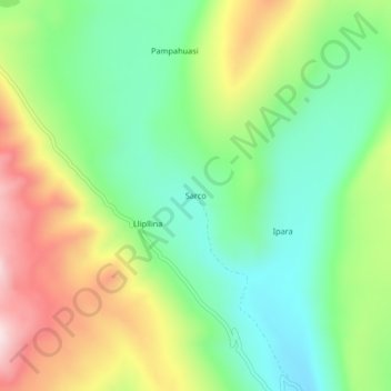
Name: Sarco topographic map, elevation, terrain.

Location: Sarco, Chipao, Lucanas, Ayacucho, Perú (-14.40795 -73.76271 -14.36795 -73.72271)

Average elevation: 4,375 m

Minimum elevation: 4,195 m

Maximum elevation: 4,666 m

Gear up for your next adventure:

💡LED Headlamp - Hands-free illumination for night hiking and camping
🥾Hiking Boots - Sturdy boots providing ankle support and traction on rugged trails
Camping Coffee Maker - Brew fresh coffee anywhere on the topographic map
🪜Heavy Duty Carabiners - Multi-use clips for securing gear to your backpack
👟Trail Running Shoes - Agile footwear for fast-paced topographic exploration

As an Amazon Associate, this site earns from qualifying purchases at no extra cost to you.