Geolocate

Palacios topographic map

Click on the map to display elevation.

About this map

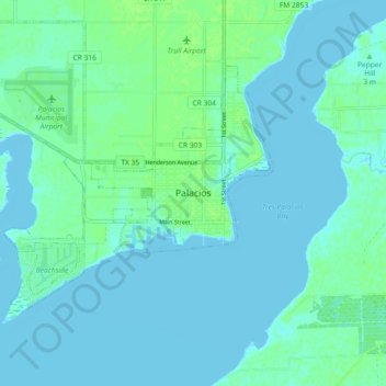
Name: Palacios topographic map, elevation, terrain.

Location: Palacios, Matagorda County, Texas, 77428, United States (28.66746 -96.25756 28.74746 -96.17756)

Average elevation: 3 m

Minimum elevation: -1 m

Maximum elevation: 10 m

Gear up for your next adventure:

🩹Moleskin Blister Pads - Direct protection for painful foot pressure points
🧢Beanie Hat - Keep your head warm in cold weather
🦯Trekking Poles - Reduced impact on joints for steep topographic climbs
🥾Hiking Shorts - Breathable shorts suitable for summer hikes
🧳Compression Sacks - Maximize space in your backpack by shrinking gear

As an Amazon Associate, this site earns from qualifying purchases at no extra cost to you.