
Thank you for supporting this site ❤️
Make a donation
Make a donation
Gear up for your next adventure:
As an Amazon Associate, this site earns from qualifying purchases at no extra cost to you.
Peralada topographic map
Click on the map to display elevation.
Thank you for supporting this site ❤️
Make a donation
Make a donation
Gear up for your next adventure:
As an Amazon Associate, this site earns from qualifying purchases at no extra cost to you.
About this map
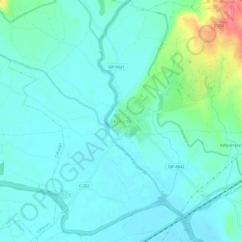
Name: Peralada topographic map, elevation, terrain.
Location: Peralada, Alto Ampurdán, Gerona, Cataluña, 17491, España (42.28850 2.98899 42.32850 3.02899)
Average elevation: 28 m
Minimum elevation: 13 m
Maximum elevation: 88 m
Thank you for supporting this site ❤️
Make a donation
Make a donation
Gear up for your next adventure:
As an Amazon Associate, this site earns from qualifying purchases at no extra cost to you.