Geolocate

Maragoli topographic map

Click on the map to display elevation.

About this map

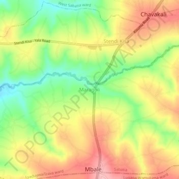
Name: Maragoli topographic map, elevation, terrain.

Location: Maragoli, Lyaduywa/Izava ward, Sabatia, Vihiga County, Kenya (0.08133 34.69949 0.12133 34.73949)

Average elevation: 1,561 m

Minimum elevation: 1,486 m

Maximum elevation: 1,629 m

Gear up for your next adventure:

🦶Anti-Blister Balm - Prevents friction and hotspots during long ascents
🧴Sunscreen SPF - Broad-spectrum sunscreen for outdoor activities
🔋Lithium AA Batteries - Long-lasting power that performs in extreme cold
🦌Outdoor Trail Camera - Monitor wildlife activity near your favorite spots
🚲Heavy Duty Bike Lock - Secure your bike at the trailhead or during stops

As an Amazon Associate, this site earns from qualifying purchases at no extra cost to you.