Geolocate

Fasa topographic map

Click on the map to display elevation.

About this map

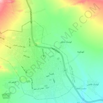
Name: Fasa topographic map, elevation, terrain.

Location: Fasa, بخش مرکزی, Fasa County, Fars Province, Iran (28.91774 53.58725 28.98675 53.66968)

Average elevation: 1,389 m

Minimum elevation: 1,327 m

Maximum elevation: 1,509 m

Other topographic maps

Click on a map to view its topography, its elevation and its terrain.

Moinabad

Iran > Fars Province > Fasa County > دهستان جنگل

Average elevation: 1,654 m

Gear up for your next adventure:

🔦UV Flashlight - Detect minerals or specific insects in the dark
🔋Solar Power Bank - Keep your GPS and devices charged during long outdoor trips
🥾Hiking Shorts - Breathable shorts suitable for summer hikes
Bushcraft Tarp - Versatile emergency shelter or gear protection
🪜Heavy Duty Carabiners - Multi-use clips for securing gear to your backpack

As an Amazon Associate, this site earns from qualifying purchases at no extra cost to you.