Geolocate

Shenandoah topographic map

Click on the map to display elevation.

About this map

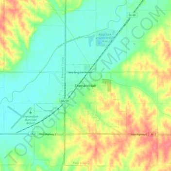
Name: Shenandoah topographic map, elevation, terrain.

Location: Shenandoah, Page County, Iowa, 51601, United States (40.72555 -95.41235 40.80555 -95.33235)

Average elevation: 311 m

Minimum elevation: 285 m

Maximum elevation: 354 m

Gear up for your next adventure:

Backpacking Tent - Lightweight tent for long-distance hiking trips
🦟Insect Repellent - Keep mosquitoes and black flies away in wooded areas
🚲Heavy Duty Bike Lock - Secure your bike at the trailhead or during stops
🧴First Aid Kit - Essential first aid supplies for outdoor emergencies
🥾Durable Hiking Shoes - Long-lasting shoes for frequent hiking

As an Amazon Associate, this site earns from qualifying purchases at no extra cost to you.