Geolocate

Buldon topographic map

Click on the map to display elevation.

About this map
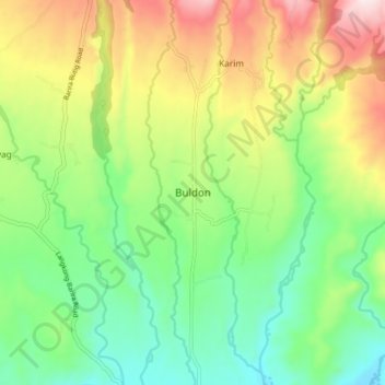
Name: Buldon topographic map, elevation, terrain.

Location: Buldon, Maguindanao del Norte, Bangsamoro, 9615, Philippines (7.47445 124.33107 7.55445 124.41107)

Average elevation: 412 m

Minimum elevation: 206 m

Maximum elevation: 749 m

Other topographic maps

Click on a map to view its topography, its elevation and its terrain.
Talitay

Philippines > Maguindanao del Norte

Average elevation: 8 m

Gear up for your next adventure:

👟Sport Hiking Sandals - Breathable footwear for water crossings and camp rest
🥾Hiking Gaiters - Protect legs and shoes from mud, snow, and debris
🥾Light Trekking Boots - Supportive boots for multi-day treks
🥾Trail Running Shoes - Lightweight and durable shoes for trail running
🥾Approach Boots - Comfortable boots for hiking and climbing approaches

As an Amazon Associate, this site earns from qualifying purchases at no extra cost to you.