Geolocate

Ridge topographic map

Click on the map to display elevation.

About this map

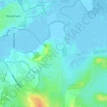
Name: Ridge topographic map, elevation, terrain.

Location: Ridge, Arne, Wareham, Dorset, England, United Kingdom (50.67521 -2.10167 50.67968 -2.08968)

Average elevation: 7 m

Minimum elevation: -4 m

Maximum elevation: 39 m

Gear up for your next adventure:

🦟Insect Repellent - Keep mosquitoes and black flies away in wooded areas
Family Camping Tent - Spacious tent suitable for family camping trips
🎒Hiking Backpack - Lightweight and ergonomic backpacks for day hikes or multi-day treks
🗺️Topographic Maps - Detailed maps to explore trails, mountains, and wilderness areas
🔦UV Flashlight - Detect minerals or specific insects in the dark

As an Amazon Associate, this site earns from qualifying purchases at no extra cost to you.