
Thank you for supporting this site ❤️
Make a donation
Make a donation
Gear up for your next adventure:
As an Amazon Associate, this site earns from qualifying purchases at no extra cost to you.
Garbarino topographic map
Click on the map to display elevation.
Thank you for supporting this site ❤️
Make a donation
Make a donation
Gear up for your next adventure:
As an Amazon Associate, this site earns from qualifying purchases at no extra cost to you.
About this map
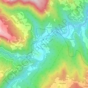
Name: Garbarino topographic map, elevation, terrain.
Location: Garbarino, Rovegno, Genova, Liguria, 16028, Italia (44.58200 9.27252 44.62200 9.31252)
Average elevation: 738 m
Minimum elevation: 487 m
Maximum elevation: 1,180 m
Thank you for supporting this site ❤️
Make a donation
Make a donation
Gear up for your next adventure:
As an Amazon Associate, this site earns from qualifying purchases at no extra cost to you.