
Cobham topographic map
Interactive map
Click on the map to display elevation.
About this map
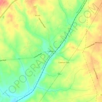
Name: Cobham topographic map, elevation, terrain.
Location: Cobham, Albemarle County, Virginia, 22942:23093, USA (38.04292 -78.28806 38.08292 -78.24806)
Average elevation: 145 m
Minimum elevation: 110 m
Maximum elevation: 178 m