
Thank you for supporting this site ❤️
Make a donation
Make a donation
Gear up for your next adventure:
As an Amazon Associate, this site earns from qualifying purchases at no extra cost to you.
Sankt Konrad topographic map
Click on the map to display elevation.
Thank you for supporting this site ❤️
Make a donation
Make a donation
Gear up for your next adventure:
As an Amazon Associate, this site earns from qualifying purchases at no extra cost to you.
About this map
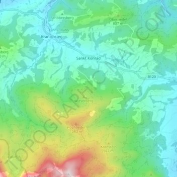
Name: Sankt Konrad topographic map, elevation, terrain.
Location: Sankt Konrad, Bezirk Gmunden, Upper Austria, 4817, Austria (47.87451 13.85071 47.93245 13.92605)
Average elevation: 734 m
Minimum elevation: 513 m
Maximum elevation: 1,388 m
Thank you for supporting this site ❤️
Make a donation
Make a donation
Gear up for your next adventure:
As an Amazon Associate, this site earns from qualifying purchases at no extra cost to you.