
Thank you for supporting this site ❤️
Make a donation
Make a donation
Gear up for your next adventure:
As an Amazon Associate, this site earns from qualifying purchases at no extra cost to you.
A Alence topographic map
Click on the map to display elevation.
Thank you for supporting this site ❤️
Make a donation
Make a donation
Gear up for your next adventure:
As an Amazon Associate, this site earns from qualifying purchases at no extra cost to you.
About this map
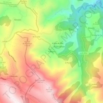
Name: A Alence topographic map, elevation, terrain.
Location: A Alence, As Nogais, Ancares, Lugo, Galicia, 27677, España (42.73347 -7.17812 42.77347 -7.13812)
Average elevation: 1,023 m
Minimum elevation: 655 m
Maximum elevation: 1,382 m
Thank you for supporting this site ❤️
Make a donation
Make a donation
Gear up for your next adventure:
As an Amazon Associate, this site earns from qualifying purchases at no extra cost to you.