
Thank you for supporting this site ❤️
Make a donation
Make a donation
Gear up for your next adventure:
As an Amazon Associate, this site earns from qualifying purchases at no extra cost to you.
Necaxa topographic map
Click on the map to display elevation.
Thank you for supporting this site ❤️
Make a donation
Make a donation
Gear up for your next adventure:
As an Amazon Associate, this site earns from qualifying purchases at no extra cost to you.
About this map
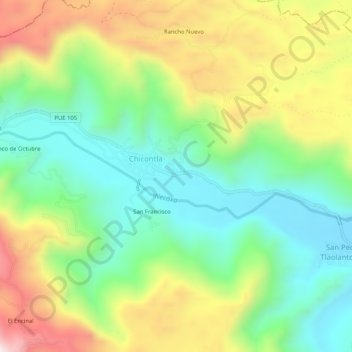
Name: Necaxa topographic map, elevation, terrain.
Location: Necaxa, Patla, Jopala, Puebla, Mexico (20.23580 -97.85254 20.24779 -97.80118)
Average elevation: 547 m
Minimum elevation: 273 m
Maximum elevation: 988 m
Thank you for supporting this site ❤️
Make a donation
Make a donation
Gear up for your next adventure:
As an Amazon Associate, this site earns from qualifying purchases at no extra cost to you.