
Thank you for supporting this site ❤️
Make a donation
Make a donation
Gear up for your next adventure:
As an Amazon Associate, this site earns from qualifying purchases at no extra cost to you.
Chogoria topographic map
Click on the map to display elevation.
Thank you for supporting this site ❤️
Make a donation
Make a donation
Gear up for your next adventure:
As an Amazon Associate, this site earns from qualifying purchases at no extra cost to you.
About this map
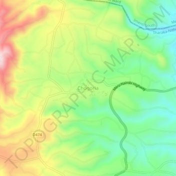
Name: Chogoria topographic map, elevation, terrain.
Location: Chogoria, Chogoria ward, Mwimbi, Tharaka-Nithi, Kenya (-0.24885 37.61199 -0.20885 37.65199)
Average elevation: 1,531 m
Minimum elevation: 1,372 m
Maximum elevation: 1,751 m
Thank you for supporting this site ❤️
Make a donation
Make a donation
Gear up for your next adventure:
As an Amazon Associate, this site earns from qualifying purchases at no extra cost to you.