Geolocate

Ozark topographic map

Click on the map to display elevation.

About this map

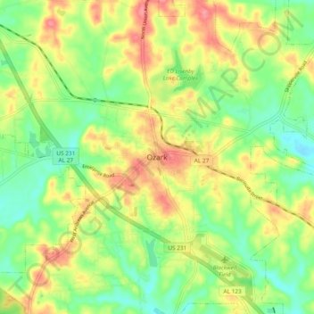
Name: Ozark topographic map, elevation, terrain.

Location: Ozark, Dale County, Alabama, 36361, United States (31.41848 -85.68059 31.49848 -85.60059)

Average elevation: 103 m

Minimum elevation: 66 m

Maximum elevation: 147 m

Gear up for your next adventure:

🧥Waterproof Pants - Keep dry during rainy hiking conditions
🕯️Camping Lantern - Illuminates your entire campsite with high-efficiency LEDs
🥾Light Hiking Boots - Lightweight and comfortable boots for day hikes
🧰Multitool Knife - Compact and versatile tool for outdoor use
🥾Hiking Shoes - Durable and comfortable shoes for trail hiking

As an Amazon Associate, this site earns from qualifying purchases at no extra cost to you.