
Thank you for supporting this site ❤️
Make a donation
Make a donation
Gear up for your next adventure:
As an Amazon Associate, this site earns from qualifying purchases at no extra cost to you.
Denbigh topographic map
Click on the map to display elevation.
Thank you for supporting this site ❤️
Make a donation
Make a donation
Gear up for your next adventure:
As an Amazon Associate, this site earns from qualifying purchases at no extra cost to you.
About this map
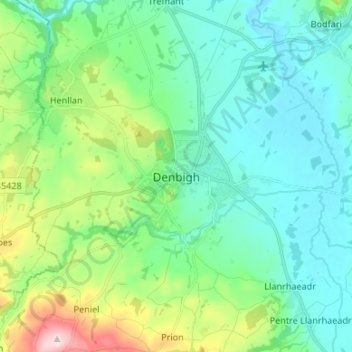
Name: Denbigh topographic map, elevation, terrain.
Location: Denbigh, Denbighshire, Wales, LL16 3UN, United Kingdom (53.14538 -3.45783 53.22538 -3.37783)
Average elevation: 102 m
Minimum elevation: 21 m
Maximum elevation: 374 m
Thank you for supporting this site ❤️
Make a donation
Make a donation
Gear up for your next adventure:
As an Amazon Associate, this site earns from qualifying purchases at no extra cost to you.