Geolocate

Trilby topographic map

Click on the map to display elevation.

About this map

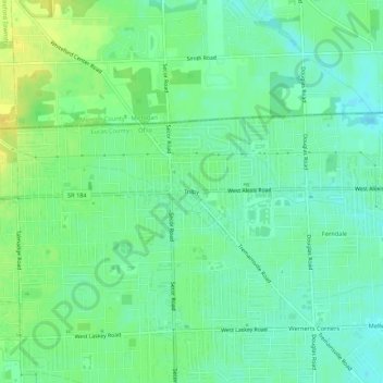
Name: Trilby topographic map, elevation, terrain.

Location: Trilby, Toledo, Lucas County, Ohio, 43613, United States (41.70089 -83.64130 41.74089 -83.60130)

Average elevation: 195 m

Minimum elevation: 185 m

Maximum elevation: 208 m

Other topographic maps

Click on a map to view its topography, its elevation and its terrain.

Ottawa Park

United States > Ohio > Lucas County > Toledo

Average elevation: 189 m

Gear up for your next adventure:

🛁Quick-Dry Microfiber Towel - Space-saving towel that dries rapidly on the move
🥾Trail Hiking Socks - Comfortable socks to prevent blisters and fatigue
🥾Mountain Trail Shoes - High-traction shoes for mountain trails
🛰️Satellite Messenger - Emergency communication for areas with no cell service
🧊Portable Cooler - Keep food and drinks cold during outdoor adventures

As an Amazon Associate, this site earns from qualifying purchases at no extra cost to you.