Geolocate

Manjalparappu topographic map

Click on the map to display elevation.

About this map

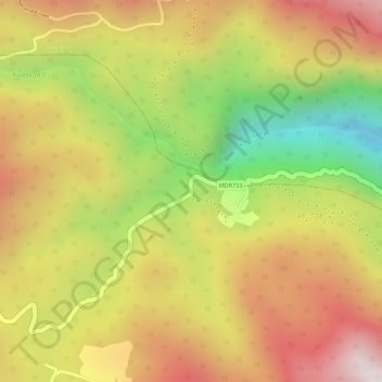
Name: Manjalparappu topographic map, elevation, terrain.

Location: Manjalparappu, Athoor, Dindigul District, Tamil Nadu, India (10.30068 77.75120 10.30336 77.75376)

Average elevation: 949 m

Minimum elevation: 543 m

Maximum elevation: 1,252 m

Other topographic maps

Click on a map to view its topography, its elevation and its terrain.

Chinnalapatti

India > Tamil Nadu > Athoor

Average elevation: 325 m

Attur

India > Tamil Nadu > Athoor

Average elevation: 299 m

Attur

India > Tamil Nadu > Athoor

Average elevation: 299 m

Gear up for your next adventure:

🪑Ultralight Camping Stool - Compact seating for rest stops during long hikes
Lightweight Camping Tent - Portable shelter optimized for Canadian backcountry camping
🥾Light Hiking Boots - Lightweight and comfortable boots for day hikes
🛌Insulated Sleeping Pad - Critical thermal barrier between you and the cold ground
🦯Trekking Poles - Reduced impact on joints for steep topographic climbs

As an Amazon Associate, this site earns from qualifying purchases at no extra cost to you.