Geolocate

Aime topographic map

Click on the map to display elevation.

About this map

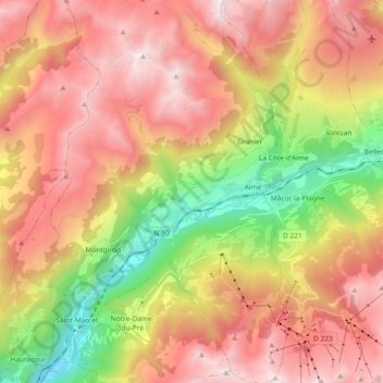
Name: Aime topographic map, elevation, terrain.

Location: Aime, Aime-la-Plagne, Albertville, Savoy, Auvergne-Rhône-Alpes, Metropolitan France, 73210, France (45.49113 6.56167 45.61997 6.66938)

Average elevation: 1,622 m

Minimum elevation: 493 m

Maximum elevation: 2,605 m

Other topographic maps

Click on a map to view its topography, its elevation and its terrain.

Gear up for your next adventure:

🥾All-Terrain Hiking Boots - Versatile boots for varied hiking conditions
🛏️Sleeping Bag - Warm and compact sleeping bags for outdoor camping
🥾Mountain Trail Shoes - High-traction shoes for mountain trails
🛶Kayak Dry Bag - Waterproof storage for kayaking adventures
🥾Trail Hiking Shoes - Durable shoes designed for rugged trails

As an Amazon Associate, this site earns from qualifying purchases at no extra cost to you.