
Pos topographic map
Interactive map
Click on the map to display elevation.
About this map
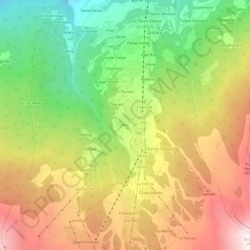
Name: Pos topographic map, elevation, terrain.
Location: Pos, Pila, Gressan, Vallée d'Aoste, Italie (45.66622 7.28700 45.70622 7.32700)
Average elevation: 1,820 m
Minimum elevation: 923 m
Maximum elevation: 2,800 m
Other topographic maps
Click on a map to view its topography, its elevation and its terrain.
Grivel
Italie > Vallée d'Aoste > Pila
Grivel, Pila, Gressan, Vallée d'Aoste, Italie
Average elevation: 1,978 m