
Thank you for supporting this site ❤️
Make a donation
Make a donation
Gear up for your next adventure:
As an Amazon Associate, this site earns from qualifying purchases at no extra cost to you.
Valada topographic map
Click on the map to display elevation.
Thank you for supporting this site ❤️
Make a donation
Make a donation
Gear up for your next adventure:
As an Amazon Associate, this site earns from qualifying purchases at no extra cost to you.
About this map
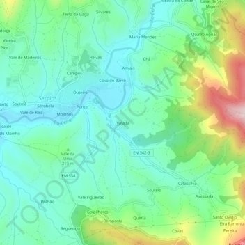
Name: Valada topographic map, elevation, terrain.
Location: Valada, Serpins, Lousã, Coimbra, 3200-358, Portugal (40.13304 -8.21170 40.17304 -8.17170)
Average elevation: 197 m
Minimum elevation: 96 m
Maximum elevation: 467 m
Thank you for supporting this site ❤️
Make a donation
Make a donation
Gear up for your next adventure:
As an Amazon Associate, this site earns from qualifying purchases at no extra cost to you.