Geolocate

Camata topographic map

Click on the map to display elevation.

About this map

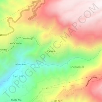
Name: Camata topographic map, elevation, terrain.

Location: Camata, Torata, Mariscal Nieto, Moquegua, Perú (-17.07745 -70.83392 -17.03745 -70.79392)

Average elevation: 2,835 m

Minimum elevation: 2,257 m

Maximum elevation: 3,383 m

Other topographic maps

Click on a map to view its topography, its elevation and its terrain.

Río Moquegua

Perú > Moquegua > Torata

Average elevation: 2,145 m

Gear up for your next adventure:

🥾Mountaineering Boots - Supportive boots for climbing and high-altitude hiking
🧥Waterproof Pants - Keep dry during rainy hiking conditions
🧭Orienteering Kit - Tools for map reading and navigation in the wild
Camping Essentials - All-in-one gear for a comfortable camping trip
🧢Beanie Hat - Keep your head warm in cold weather

As an Amazon Associate, this site earns from qualifying purchases at no extra cost to you.