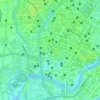
Iputinga topographic map
Click on the map to display elevation.
About this map

Name: Iputinga topographic map, elevation, terrain.
Location: Iputinga, Recife, Pernambuco, Região Nordeste, Brasil (-8.04989 -34.94548 -8.02192 -34.92590)
Average elevation: 11 m
Minimum elevation: 1 m
Maximum elevation: 37 m
Other topographic maps
Click on a map to view its topography, its elevation and its terrain.
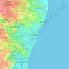
Recife
Brasil > Pernambuco > Recife
A altitude média em relação ao nível do mar é de quatro metros. Sua área territorial é composta de 67,43% de morros, 23,26% de planícies, 9,31% de áreas alagadas (aquáticas) e 5,58% de zonas especiais de preservação ambiental (ZEPA).
Average elevation: 23 m