
Thank you for supporting this site ❤️
Make a donation
Make a donation
Gear up for your next adventure:
As an Amazon Associate, this site earns from qualifying purchases at no extra cost to you.
Liebhards topographic map
Click on the map to display elevation.
Thank you for supporting this site ❤️
Make a donation
Make a donation
Gear up for your next adventure:
As an Amazon Associate, this site earns from qualifying purchases at no extra cost to you.
About this map
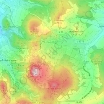
Name: Liebhards topographic map, elevation, terrain.
Location: Liebhards, Hilders, Landkreis Fulda, Hessen, Deutschland (50.53947 9.89394 50.57083 9.97187)
Average elevation: 573 m
Minimum elevation: 423 m
Maximum elevation: 807 m
Thank you for supporting this site ❤️
Make a donation
Make a donation
Gear up for your next adventure:
As an Amazon Associate, this site earns from qualifying purchases at no extra cost to you.